
Leica CS50 field controller and Leica Captivate 2027 field software
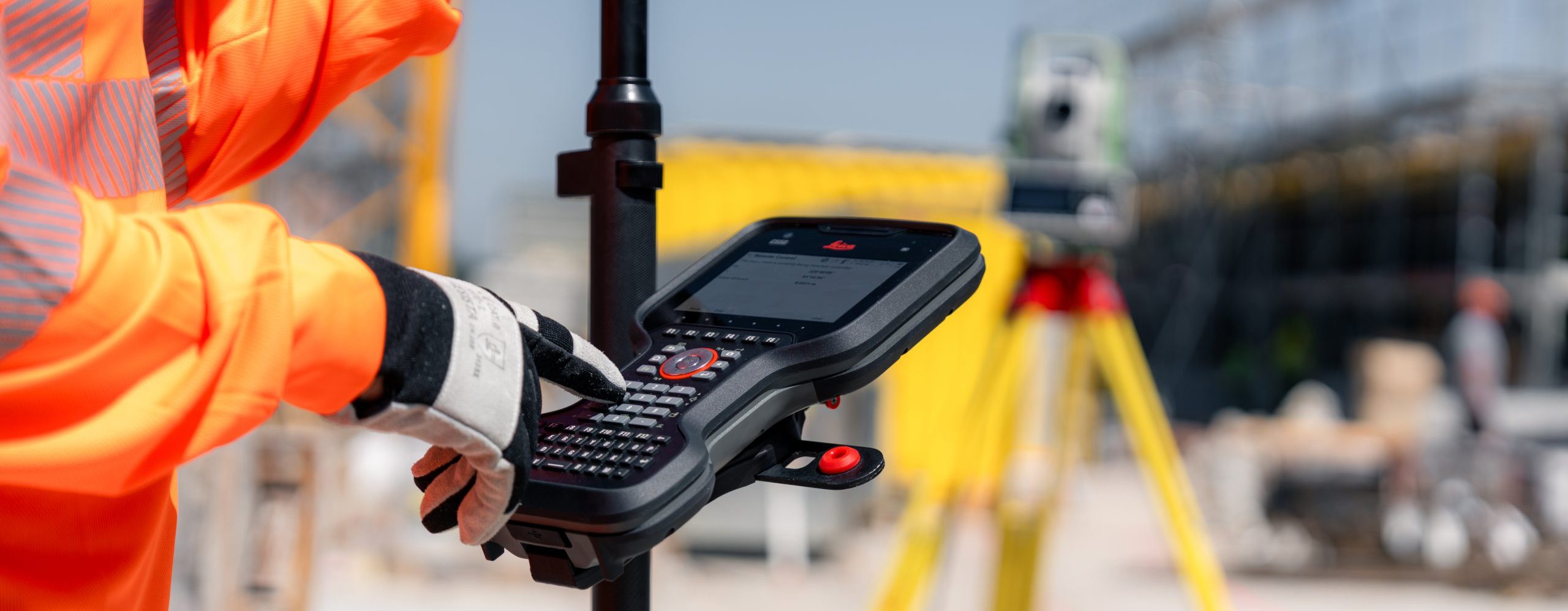 Introducing the new Leica CS50 field controller and Leica Captivate 2027 field software, designed to help surveyors work more efficiently, maintain reliable positioning in challenging environments, and set out points with greater confidence.
The CS50 keeps up with the demanding timelines of fieldwork, even when handling large survey datasets. Captivate 2027 adds AI-RTK for faster and more reliable GNSS positioning around obstructions, camera-based GNSS visual stakeout, and shared projects for efficient collaboration.
Surveying crews increasingly need to work with large CAD and IFC files on site, measure close to buildings and vegetation that can disrupt GNSS signals, and access the right project data quickly. The latest Captivate releases address surveyors’ evolving work realities with advances across instruments and software that deliver overall productivity gains:
- Work efficiently with complex datasets: The CS50 combines fast processing and a multi-touch display with a tactile, backlit keypad. Its rugged design supports familiar one-handed operation, while fast, responsive performance helps surveyors work efficiently with large datasets in the field.
- AI-RTK for reliable GNSS measurements in challenging environments: This new Leica GS18 feature uses artificial intelligence to distinguish reliable GNSS signals from those disrupted by the environment to help maintain accurate positioning.
- Find stakeout points faster: Visual stakeout overlays stakeout points onto the live camera view of the Leica GS18 I, showing surveyors which way to go and helping them reach points easily and quickly.
- Keep field and office teams working with the right project information: Collaborative projects provide a common structure for project information, files, and settings across Captivate, Leica Infinity, and Hexagon GeoCloud, making it easier to find and work with the right project data across field and office workflows.
Leica RTC Series

Leica Geosystems’ new Leica RTC series sets the new benchmark in scanning accuracy and productivity
Industry-leading sensors paired with a real-time collaboration workflow let teams scan faster, start collaborating immediately, and keep projects moving towards deliverables
Advanced 3D laser scanning: The new Leica RTC laser scanners capture data faster and 35% more accurately than its nearest competitor.- Real-time collaboration: Industry-first Livelink capability enables project teams to connect and collaborate during scanning, so they can spot data gaps before they leave the site and start work on deliverables sooner.
- Upgradeable scanning platform: The RTC series comes in three performance tiers. As project needs grow, teams can move to a higher tier without replacing their systems.
- Scalable superior performance The new RTC series combines the speed, capability and versatility of the Leica RTC360 with the robustness and superior accuracy of the ScanStation P-Series, enabling specialised workflows across surveying, construction, industrial plants, public safety, and infrastructure. It includes three performance tiers based on the same platform: As projects grow in size and demand, users can upgrade to a higher performance tier without replacing their system.
- Connected workflows As project schedules compress and data volumes grow, geospatial teams are expected to deliver reliable, decision-ready information while work is still in progress. With the new RTC series, scanning, registration, and data sharing become one continuous process: 3D data moves between field, cloud and office. Livelink, a new capability in Leica Cyclone FIELD 360, streams scan data to Hexagon GeoCloud as it is captured. Multiple scanners can feed into one shared project in real time. Teams can reduce rework by confirming they've covered the entire site before the field crew leaves – and start producing deliverables even before scanning is finished.

TS20 AI-powered surveying
 AI-powered surveying delivers real results in the field
The new Leica TS20 isn’t just an upgrade - it’s a complete ground-up rebuild, combining familiar, enhanced and innovative features designed to improve productivity in the field.
It is also the first robotic total station equipped with on-device (edge) AI. This allows the TS20 to perform AI computations directly within the instrument, enabling faster decision-making and helping reduce mistakes during everyday fieldwork.
Download the AI-Powered Surveying Guide
- How on-device AI delivers instant automation, security, and future-ready performance.
- How AI capabilities reduce mistakes and downtime in real-world conditions.
- How AI target recognition delivers fast, reliable accuracy in any environment.

New Equipment
Caddbro - precision delivered, reliability restored. We are your first stop for all Leica products, being the number one Leica approved partner in the South East and having access to Leica’s vast range of products, along with our extensive knowledge and experience, we can advise and guide you in putting together the best package for your needs and price range. All new equipment is quality checked by our dedicated technicians prior to being despatched to you. Our preferred delivery method is in our company vans by friendly and helpful delivery staff who ensure your equipment reaches you in perfect factory condition. This is of course providing your delivery destination is within our delivery range. Alternatively, we use next day couriers and provide you peace of mind with tracking and delivery insurance. Conveniently situated in Southeast London and on the Kent border, with direct access to the M25 and Dartford tunnel we are ideally placed to delivery to you quickly.
Further afield? We will consider any request, just pick up the phone and we will accommodate your needs if possible.
Don’t hesitate to contact us by phone or email with your requirements or advice on any product. Not all available products are shown on our website, so please enquire if you can’t see what you need or just want some advice.