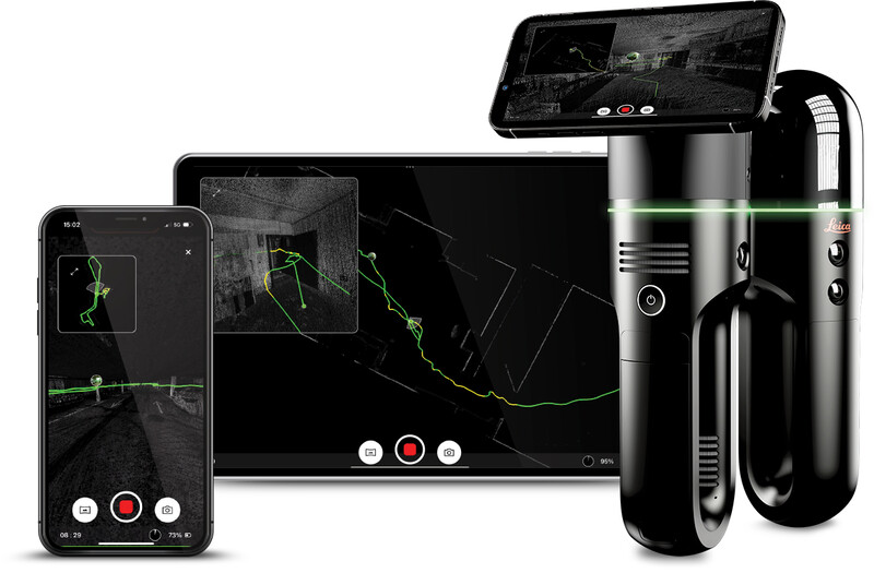
The Leica BLK2GO PULSE is a first-person scanner that provides a complete, streamlined, end-to-end reality capture solution using the BLK Live app. With instant capture, immediate access to data, and PULSE technology, the BLK2GO PULSE delivers complete, colorized point clouds instantly in the field with no post-processing required. The technology is based on Dual solid-state Time-of-Flight (ToF) sensors designed for indoor reality capture applications.
Cyclone REGISTER 360 PLUS (BLK Edition) is optimized for use with the BLK2GO PULSE including support for its image, point, and trajectory data and the ability to combine BLK2GO PULSE with data from other sensors. Users who wish to register their BLK2GO PULSE data to other sensors should consider Cyclone REGISTER 360 PLUS Standard or Cyclone REGISTER.
The BLK2GO PULSE includes a free, dedicated companion app, the BLK Live, which is known from previous BLK sensors. It has been redesigned specifically to maximize the capabilities of the BLK2GO PULSE and provide the best possible first-person scanning experience and workflow.
The BLK2GO PULSE can be connected to Cyclone REGISTER 360 PLUS or Cyclone REGISTER 360 PLUS (BLK Edition) via Wi-Fi or USB cable. Cyclone REGISTER 360 PLUS (BLK Edition) is optimized for use with the BLK2GO PULSE. The software will help users with post-processing and cleaning up captured data (if needed), registering separate scan paths, and exporting and publishing data in different formats for deliverable creation. Once connected, Cyclone REGISTER 360 PLUS (BLK Edition) will show the Jobs (a.k.a. Projects in Cyclone REGISTER 360 PLUS) which contains the Walks (unique capture events) listed in the import area.
The scanner has three panoramic cameras that are used to capture images every second which can be turned into panoramic setup locations along the trajectory (or walking path) of the scan. These images are also used to colorize the point cloud data.
At import, the user will set an interval for how often these panoramic setups are created. The setups are known as WayPoints and are located along the scan path to show panoramic imagery for a more traditional setup location experience.
Upon import, Cyclone REGISTER 360 PLUS will import the point cloud data and pano images per-user setting. The user can set the WayPoint creation every 1-meter or more, along the trajectory. It is not necessary to create WayPoints to import BLK2GO PULSE data, but at least one WayPoint must be created to import the data with at least one handle or WayPoint to move and rotate the data in the SiteMap area.
The BLK2GO PULSE scanner also has one high-resolution camera. When the image capture button is pressed, a 12-megapixel image will be captured from the front of the scanner. Upon import, the image is turned into a GeoTag which is accessible downstream in Cyclone ENTERPRISE, LGS/LGSx, TruView, CloudWorx, etc.
For more information about scanner operation please refer to the manual included with your scanner.
The BLK2GO PULSE scanner can also be connected to the BLK Live App and the Cyclone FIELD 360 App for both Android and iOS devices.